As I work in a school I get long summer holidays. These were great when the children were younger, but now they’re grown up with lives of their own I have a lot of spare time. One of the ways I’ve kept busy this year is by walking to the coast from my house in Oxfordshire.
The route
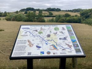
I walked to Portishead, from Oxfordshire, via Lambourn, Marlborough, Calne, Bath and Bristol. This was planned with the help of the Slow Ways website, which aims to connect all of Great Britain’s towns and cities with walking routes.
It wasn’t the shortest route, but one I could complete using public transport. To keep costs down I stayed at home and used buses and trains to get and from the walk each day. Of course, as I got further from home this got trickier and more expensive.
I also didn’t walk on consecutive days, due to weather and other commitments. I definitely made a good decision to miss a day when thunderstorms rolled through. And I made sure my final day was a sunny one.
The mileage shown below includes walking to and from public transport connections at both ends of the walk.
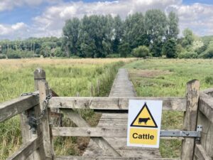
Day 1: home to Wantage (10 miles)
This was a day walking through familiar territory. It’s a route I knew well as it was close to home but there were still surprises. I watched hares and deer romping around the fields, and listened to a nearby music festival. At one point I was passed by a large number of cyclists who appeared to be on an organised holiday. Even though it was only late July, the damsons, sloes and blackberries were already ripening.
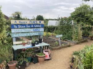
Despite thinking I knew this route well I still discovered new pleasures, including a small community garden near Ardington. Very handily it had a toilet!
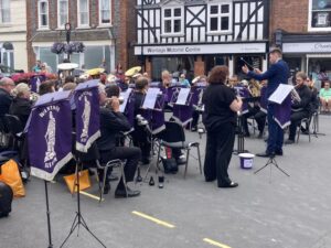
I timed my arrival into Wantage perfectly. The local silver band were setting up for an afternoon performance in the market square so I took a seat in a nearby cafe and enjoyed the music, before catching a bus home.
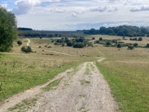
Day 2: Wantage to Lambourn (10 miles)
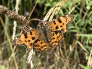
Day 2 involved another relatively short walk across the downs to the horse racing mecca of Lambourn. It was hillier than day 1, with a couple of steep stretches. I saw a group of walkers and several cyclists on the Ridgeway, but not a soul the rest of the route. Instead my companions were skylarks and clouds of butterflies, like nothing I’d seen in the UK before.
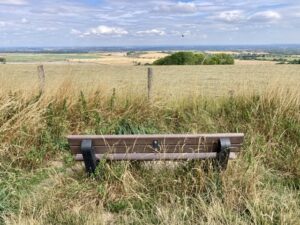
I walked on through the extensive lands of Sheepdrove Organic Farm and alongside a long verge planted with scabious, knapweed and native hedging. At one point a shrew ran out in front of me and I had to do a little skip to avoid stepping on it.
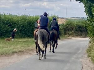
There was no mistaking that Lambourn is a racing town. It had a saddlers, a jockey welfare charity, and an equestrian estate agent. Every other person in the high street wore jodhpurs. And even the Indian restaurant had pictures of racehorses on its sign.
Due to missed transport connections I had to hang around in Lambourn for a while. This meant the journey home took longer than the walk. On the positive side, I really enjoyed the bus ride back to Newbury, from where I picked up my onward connection.
Day 3: Wantage to Marlborough (16 miles)
After a very early start and two buses I followed the hoof prints out of Lambourn.
There was no-one to be seen again on the route, until the silence was shattered by several off-road motorbikes. I half expected to get mown down but they unexpectedly turned out to be polite older men.
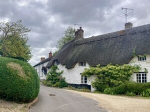
I headed towards the hum of the M4, crossing it to reach the picturesque village of Baydon, then Aldbourne where I stopped for lunch.
At Ramsbury I discovered an idyllic swimming spot. There were kids bikes and clothing discarded beside the path. It was reminiscent of an Enid Blyton book. Until I heard the “Don’t you f’ing dare”, shouts from the youngsters.
The remainder of the afternoon challenged me, with routes through woods ending in nettles and locked gates with no stiles. The owner of the field below really didn’t like walkers!
The day ended in Marlborough, where I had some spare time to look round the posh charity shops, before a bus journey and train ride home.
Day 4: Marlborough to Calne (17 miles)
I walked the first part of this route with two friends. They’re experienced hill walkers and were much more prepared than me, with first aid kit, survival bag and waterproof trousers. Fortunately none of these items were needed!
The morning passed in a blur of conversation, Saracen stones and rolling downland views. Before we knew it we were walking past the standing stones at Avebury. I’ve visited before but this time they were heaving with tourists.
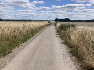
After a satisfactory lunch in a wasp infested cafe I said my goodbyes, as my friends headed back to Marlborough. I also left behind the crystal enthusiasts and crop circle hunters and set off on a long lonely road. This mostly followed the National Cycle Network route 403, before eventually finishing in Calne.
Day 5: Calne to Corsham (14 miles)
I took the train to Chippenham and waited ages for a bus back to Calne, only to discover they weren’t calling at the railway station due to roadworks. Argh! I sprinted into town and fortunately managed to get the next bus.
Once I finally started walking I continued to follow cycle route 403. As it was a dedicated trail there were no route finding issues. Despite the plethora of runners and cyclists I still saw plenty of wildlife – a muntjac hopped out in front of me and there was a huge flock of goldfinch flitting about the trees. That was until a sparrowhawk swooped through, at which point they all disappeared.
I stopped for lunch in Chippenham, and then walked besides an industrial estate and new housing development. When I finally escaped into the countryside I saw the one thing I’d been dreading from the start. A lone man in the middle of nowhere! Now I know that lone men are not usually axe murderers but as a solo female walker it’s the thing that goes through your (my) head. Anti-climax alert, we said hello as we walked past each other…
The saving grace to a rather boring afternoon of walking was Corsham. It’s a relatively small market town, with lots of Georgian houses, cobbled streets and parkland surrounding Corsham Park. A cheaper smaller version of Bath, without the tourists. I rather liked it.
Day 6: Corsham to Bath (13 miles)
As pre-9.30am weekday train travel is prohibitively expensive this was another late start, compounded by a poorly timed bus to Corsham. As a result, I decided to finish the rest of my walk on weekends – no more weekday travel restrictions!
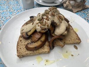
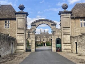
My morning route from Corsham followed the railway line for a while, past a disused quarry and fields of something that looked like bamboo. Not far from me was Box Tunnel, one of Brunel’s masterpieces, once the longest tunnel in the world. Onwards through the grounds of Hazelbury Manor (yours for just £7.5 million). This was followed by a steep slippy walk down into Box where I stopped for lunch at The Birdhouse Cafe.
I got to walk off my lunch with another steep hill out of Box, I had to stop a couple of times to admire the view. I also, unknowingly, detoured from my Slow Ways route, by continuing to walk along a road, rather than head off-road.
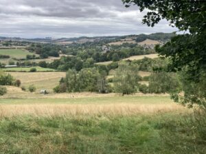 Climbing the hill out of Box
As I walked along the unplanned road I got rather excited at the waste and recycling bins which had ‘Wiltshire’ written on the side of them. It made me realise how far I’d walked!
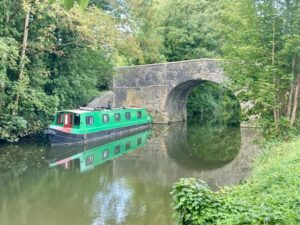
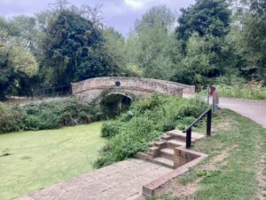
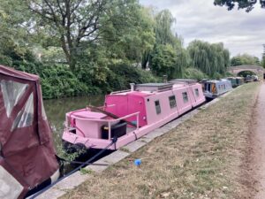
The last couple of miles were along the canal into Bath. It made for easy walking and it was good to spy on the alternative lifestyles of some of the narrowboat owners. As expected, so close to Bath, the path was very busy.
Even so, it was a shock walking into Bath. As lovely as the city is, it’s not at its best when over run with visitors. I appreciate I visited in peak season but it was a relief to escape the city and head home.
Day 7: Bath to Bristol (19 miles)
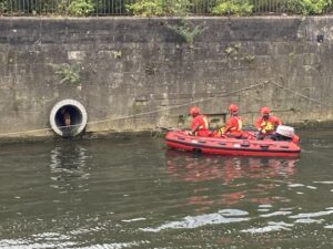
It was an exciting start to the walk! Shortly after leaving Bath railway station I came across a deer rescue. A fawn was swimming around the River Avon unable to escape due to the large walls either side of the river. The rescue took about 20 minutes, during which time I discovered that deer can screech incredibly loud. I read later that it was successfully released back onto firm ground.
Much of the day was spent following the river. It was surprisingly rural, despite the proximity of the two big cities. I saw several herons, lots of ducks and for a while walked at the same pace as a trio of canoeists.
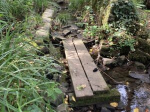
After leaving Keynsham, where I’d stopped for lunch, I ran into an unexpected challenge. A path through a small patch of woodland, which looked simple on the map, turned into a battle against Himalayan balsam. There was also a small wetland area to cross, using only sandbags and wooden planks. I ended up getting my first wet feet of the trip. After leaving this I then had to climb out of the woodland and over a crash barrier to walk alongside the edge of a fast road.
Fortunately it wasn’t long before I was back walking beside the river and following the River Avon trail. Even if I did appear to be accompanied by a large graffiti covered sewage pipe for some of the way. It was a very warm afternoon so I was happy to find a handily located pop-up truck at Conham River Park, where I enjoyed an iced coffee.
The final section of the day took me into the Bristol suburbs; still following the waterway but now surrounded by old warehouses, car repair centres and building sites. Only one day of walking left now!
Day 8: Bristol to Portishead (15 miles)
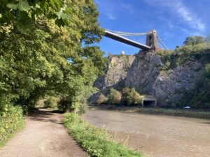
I was joined by my partner for the final day. We followed the River Avon Trail out of Bristol, underneath Clifton Suspension Bridge and onwards towards Pill. This was easily the busiest route of the entire walk, as we shared it with a never ending stream of runners and cyclists.
Given the proximity to Bristol I had high hopes for a leisurely lunch in a cafe somewhere but, we discovered belatedly, not on a Sunday. Instead we found a friendly coffee shop in Pill, just a pity it didn’t do lunches.
After passing under the M5 we spent half an hour walking past car storage yards. They were full of hundreds, possibly thousands, of brand new cars. I’ve seen them when driving past on the M5 before but the scale only becomes apparent when you’re on the ground next to them.
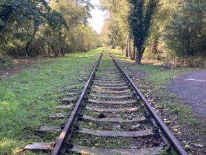
We also walked beside the old train line to Portishead. This is due to re-open in 2028 but it looks like they have some serious restoration to do if they’re going to meet this date.
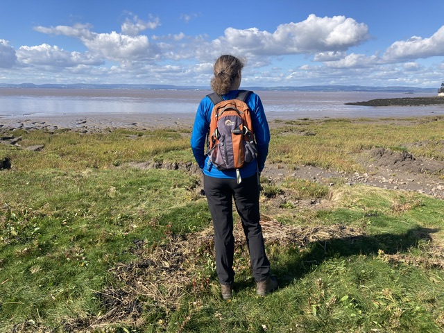
I was excited to reach Portishead, but the end of my walk was a little disappointing. I had planned to dip my toes in the sea at Portishead, but hadn’t realised the beach we’d gone to was mostly mud! I’m sure there’s sand somewhere but we were on a tight schedule as we had to catch a bus back to Bristol so we could reach our train.
Never mind, it was lovely to see the sea. And to have walked 114 miles to get there!
What did I learn?
- I should be more scared of delivery vans and farm traffic than lone men out for an afternoon walk.
- Public transport can be expensive and frustrating, but £3 bus rides through beautiful countryside and villages makes up for it.
- Tourists are concentrated in just a few well-known spots. Take a footpath in the opposite direction and you’ll be on your own in 30 minutes.
- You can have an adventure from your doorstep!
Challenge completed
Challenge completed. Pop over to read the full list of my 60 things to do before I’m 60.